


Pike 2 Bike Information
A Rich History
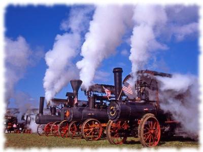
The Pennsylvania Turnpike (America's first "superhighway") was opened to traffic in 1940. At that time, the tunnels on the Turnpike had only one travel lane in each direction. The result was significant bottlenecks as traffic increased over the years. In order to alleviate these bottlenecks, additional relief tunnels were added at most locations. However, for an 11-mile section of Turnpike that included Rays Hill Tunnel (0.7 miles) on the border of Bedford and Fulton Counties, and Sideling Hill Tunnel (1.3 miles; the longest tunnel on the Turnpike) in Fulton County, a new roadway was constructed and opened in 1968. The abandoned section and two tunnels continued to be used sporadically for various purposes, but slowly deteriorated. Over time, interested citizens have retained maps, letters, photographs and artifacts of the changes and uses this stretch of land has endured over the past one hundred years. This rich history has led advocates to push for the tunnels' preservation and public use.
A New Start
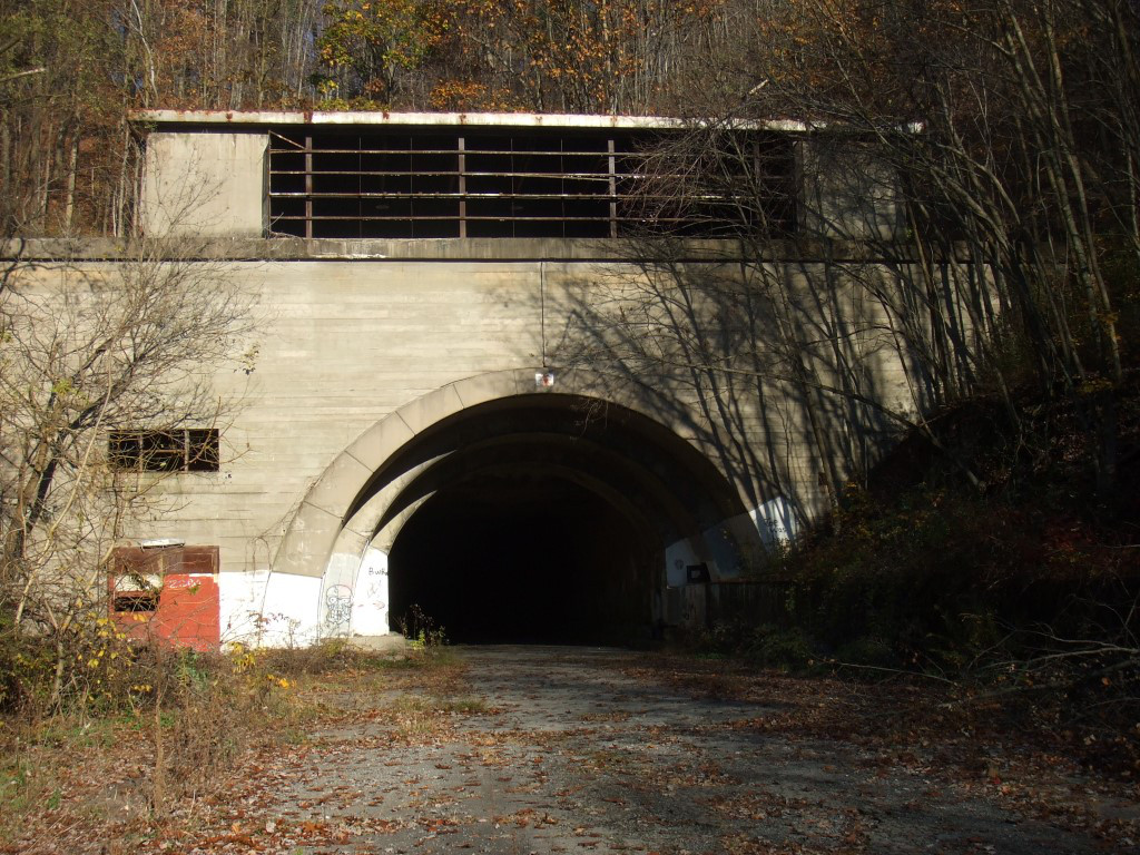
In 2000 the Turnpike Commission chose to return the abandoned section to the public sector. In 2001 ownership of 8.5 miles of roadway including the two tunnels was transferred to the nonprofit Southern Alleghenies Conservancy (SAC), with the intention of rehabilitating the roadway and tunnels into a multi-use trail corridor - the Pike2Bike. SAC commissioned the Master Plan several years later and it was finalized in 2006. The estimated cost for the full project (2005 dollars) was $3.05 million. Several ownership and management models were also investigated in the Master Plan. However, an analysis of the potential economic impact of the proposed trail, vital to advancing the funding and construction of the project, was not included in the Master Plan. In addition, in 2001, the Rails to Trails Conservancy (RTC) conducted a detailed summary of national trails containing tunnels. Entitled Tunnels on Trails, the study documented 78 tunnels on 36 trails in the United States.
The Latest Progress
In the summer of 2013, the Fulton and Bedford County Commissioners launched a planning process to update the Pike2Bike Trail Network Master Plan and Adaptive Re-Use Study (2006). The vision for the Pike2Bike trail project is to develop an 8.5-mile section of the abandoned Pennsylvania Turnpike located in both Fulton and Bedford Counties into a destination, multi-purpose trail. Based upon the RTC study findings and independent web research, if developed and promoted, the Pike2Bike 8.5-mile, two-tunnel trail is likely positioned to be the largest and longest former road-use, two-tunnel trail in the country-boasting over 10,500 feet of through-tunnel experience. The final product from the Plan and Adaptive Re-Use Study update that was begun in 2013 is entitled Economic Impact Analysis of the Proposed Pike2Bike Trail. This Analysis was formally adopted by the Fulton and Bedford County Boards of Commissioners in May of 2014. In addition to this work, in May of 2014 Mr. John B. Maxwell finished a Plan for the Eastern Trailhead of the Pike2Bike which provides very useful information for owners of property in the area of the Eastern Trailhead, which lies solely in Fulton County.
In the News
- 01-15-2020: The Bedford/Fulton County Joint Recreation Authority will hold public meetings in the East Providence Township Building on the 3rd Monday of every month at 6 PM.
- 09-25-2014 Pike2Bike Rehab Proposal Heard In Harrisburg Monday
- 02-20-2014 Pike 2 Bike Study Findings Released
- 06-06-2013 Public Urged To Attend Pike2Bike Meetings